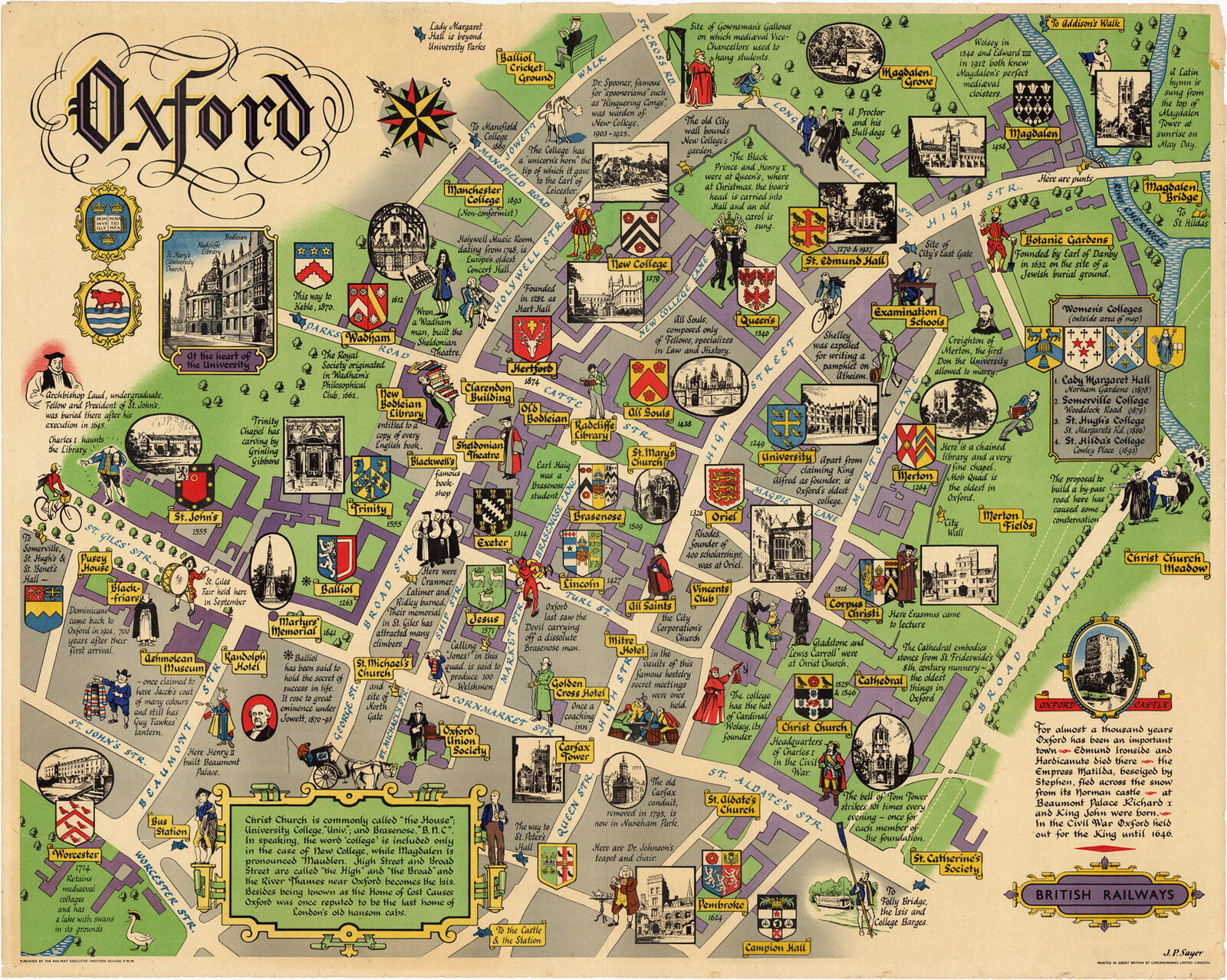
Pictorial Map of Oxford London British Railways Historic Antique Wall Art Poster

When you click on links to various merchants on this site and make a purchase, this can result in this site earning a commission. Affiliate programs and affiliations include, but are not limited to, the eBay Partner Network.
Pictorial Map of Oxford London British Railways Historic Antique Wall Art Poster:
$13.00
Map of Oxford. British Railways.
Detailed Specifications
This is a reproduction of the original map
This Map Comes in Sizes:
11\"x14\", 16\"x20\" and 23\"x29\"
Wehave more Transportation Maps, you can find themin
OurStore
Wehave more Pictorial Maps, you can find them in
OurStore
Vignettes illustrating landmarks, along with figures in period costumes, illustrating Oxford\'s storied history.
All the colleges are marked with small black and white images of the buildings.
At the right is a listing of four Women\'s Colleges which are noted as being outside the area of the map.
The map covers the following area:
from St. John\'s and the Ashmolean at the left edge to the River Cherwell and Broad Walk at the right edge, from Balliol Cricket Ground and Manchester College to Magdalen at the upper edge and from Worcester to Campion Hall at the lower edge.
This map comes with a white border around the image----------------------------How are the prints shipped?They are rolled and placed into a rigid tube.
-Is this available in a larger/smaller size.Yes. For smaller or larger sizes, email us.
Pictorial Map of Oxford London British Railways Historic Antique Wall Art Poster:
$13.00
